

The UK is in the grip of a dramatic weather shift as thunderstorms sweep across the country, bringing torrential rain, frequent lightning, and the threat of flooding. The Met Office has issued a series of yellow and amber warnings, urging residents to prepare for severe weather after a spell of record-breaking heat. This turbulent period has seen some of the most intense thunderstorms in recent years, with experts warning of significant disruption to daily life.
Heatwave Sets the Stage for Storms
The recent surge in temperatures has played a crucial role in fuelling these thunderstorms. On Friday, parts of the UK recorded their hottest day of the year so far, with temperatures soaring to 29.4°C in Suffolk and potentially reaching up to 34°C in eastern England. These figures are well above the average for June, with some regions experiencing temperatures 7 to 10°C higher than usual. The combination of heat and humidity has created the perfect conditions for thunderstorms to develop, especially as cooler Atlantic air begins to move in.
Met Office Warnings: What Do They Mean?
The Met Office, the UK’s official weather service, has been at the forefront of issuing timely warnings. Their colour-coded system helps the public understand the severity and likelihood of weather impacts. Yellow warnings indicate a risk of disruption, while amber warnings suggest a higher likelihood of severe impacts, including flooding, power cuts, and damage to property. In extreme cases, red warnings are issued, signalling a danger to life and widespread disruption.
Currently, yellow and amber thunderstorm warnings cover large swathes of the country, including eastern and southern England, Wales, and parts of Scotland. The most severe amber warning was issued for East Anglia and the southeast, effective from Friday night into Saturday morning, with the potential for torrential rain, large hailstones, and gusty winds.
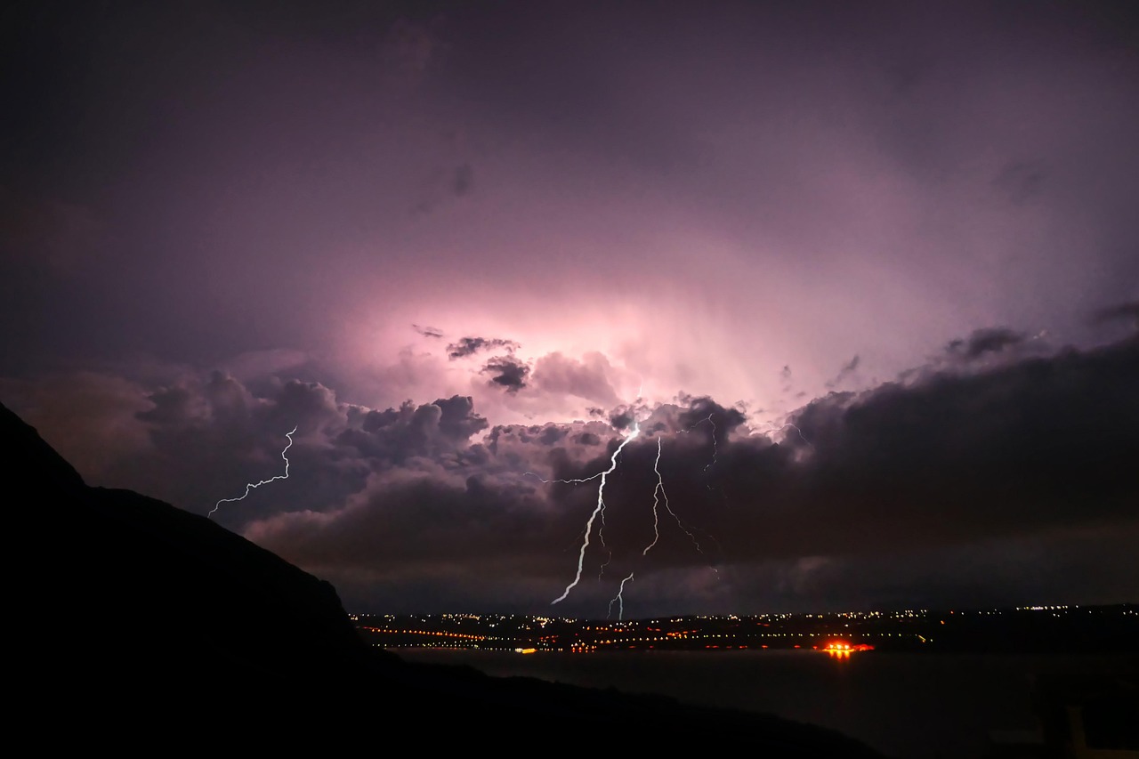
Lightning Strikes and Flooding: The Immediate Threats
Over 30,000 lightning strikes were recorded overnight as thunderstorms swept across England, with the majority occurring over the sea but many still hitting land and causing significant disruption. Kent, in particular, experienced flash flooding, leading to road closures and delays on public transport. The Met Office warned that some areas could see 30-50mm of rain in just a few hours, with isolated spots potentially receiving up to 80mm.
Flooding remains a major concern, especially in low-lying areas and urban centres where drainage systems can quickly become overwhelmed. The risk of power cuts and damage to homes and businesses is heightened during these intense storms, and emergency services are on high alert.
Tornado Watch: A Rare but Real Possibility
In an unusual twist, the Met Office has also raised the possibility of tornado activity in parts of the UK. While tornadoes are rare in Britain, the current mix of atmospheric conditions means they cannot be ruled out, particularly in areas covered by the thunderstorm warnings in northern England and southeast Scotland. Meteorologists stress that while the likelihood remains low, all the ingredients for tornado formation are present, and they will be monitoring the situation closely throughout the evening and night.
Travel Disruption and Public Safety
The impact on travel has been immediate. The Met Office and local authorities have advised against unnecessary journeys, especially during periods of heavy rain and lightning. Train and bus services have faced delays and cancellations, and drivers are warned of hazardous conditions due to surface water, reduced visibility, and sudden flooding. Residents in affected areas are urged to stay indoors where possible and to check on vulnerable neighbours who may need assistance.
Expert Insights: Why Are UK Thunderstorms Becoming More Intense?
Thunderstorms are not uncommon in the UK, but their intensity appears to be increasing. Experts suggest that climate change may be playing a role, with warmer air holds more moisture and leading to heavier downpours when storms do occur. The UK’s long-term average rainfall for June is 77.2mm, but some areas have seen nearly half that amount in just a few hours during recent storms.
The Met Office explains that these storms are often triggered when hot, humid air collides with cooler Atlantic air, creating instability in the atmosphere. This instability, combined with high moisture levels, leads to the formation of towering thunderclouds capable of producing intense rainfall, hail, and frequent lightning.
Looking Ahead: Will the Storms Continue?
The current spell of severe weather is expected to gradually subside as the weekend progresses, with temperatures returning closer to the seasonal average as a new Atlantic air mass arrives. However, the Met Office warns that the weather will remain changeable, with further showers and periods of rain likely in the coming days. Residents are advised to keep up to date with the latest forecasts and to take any warnings seriously.
Staying Safe During Thunderstorms
The Met Office offers clear guidance for staying safe during severe weather. Avoid travelling unless absolutely necessary, stay indoors during lightning storms, and steer clear of floodwaters. If you experience a power cut, check on neighbours and vulnerable individuals, and follow advice from emergency services.
Conclusion
This week’s thunderstorms have served as a stark reminder of the power of nature and the importance of preparedness. With climate patterns becoming more unpredictable, staying informed and heeding official warnings is more vital than ever. As Britain moves from heatwave to downpour, the resilience of communities and the effectiveness of emergency planning will be tested. For now, the advice is simple: keep an eye on the skies, listen to the experts, and stay safe.
To read more click here